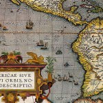
Argentina before becoming a Nation-State covers just over half the territory of the former Spanish colonial institution.
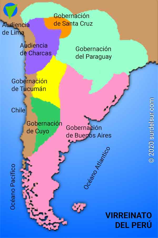
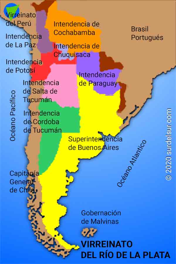
Created in the early seventeenth century the Viceroyalty of Perú occupied the space of the Inca Empire, including the current Argentine territory. Later the business activity in the territory of Argentina, before becoming state determines the autonomy of the Viceroyalty of the Río de la Plata, created on 1 August 1776. The decline of the Spanish empire and competition for the American market powers like England and Portugal boosted the dismemberment of the Viceroyalty leading, according to their political and economic opportunities, Paraguay, Alto Peru (Bolivia), la Banda Oriental (Uruguay) and Argentina.
Viceroyalty of Peru
The first colonizers to arrive in South America were Spaniards. In a way, this happened by mere chance, since they intended to find a passage to India. Basically motivated by the expectations of finding precious metals, it is not surprising that the Spanish crown should consider Lima rather than Buenos Aires, which only had virgin lands and nomadic tribes with hostile natives.
That is why the Viceroyalty of Peru developed slowly, always under the shadows of the Inca Empire.
It was the interest aroused by the development of the port of Buenos Aires for countries such as Portugal (which expanded its colonizing campaigns up to Plata River), England and France, (which carried out expeditions in Patagonia and Malvinas) that made Spain aware of the importance and autonomy of this region.
It was the interest aroused by the development of the port of Buenos Aires for countries such as Portugal (which expanded its colonizing campaigns up to Plata River), England and France, (which carried out expeditions in Patagonia and Malvinas) that made Spain aware of the importance and autonomy of this region.
Viceroyalty of Río de la Plata : Argentina before becoming a Nation-State
Argentina before becoming a Nation-State, covering more than half the territory of the Viceroyalty of the Río de la Plata, created in 1976. While, in the beginning, the population was distributed among different points of the interior, but, thanks to the prosperity of the littoral stockbreeders and the merits of the port of Buenos Aires, from which leather, tallow and wool were exported, economic activity was increasingly centered in Buenos Aires.
When May Revolution broke out in 1810, Plata River was a valued business center which sought to get rid of the Spanish monopoly. European powers which were more recent and stronger than the worn-out Spanish empire, such as England, boosted the dismemberment of the Viceroyalty, giving rise to Paraguay, Alto Perú (Bolivia), la Banda Oriental (Uruguay) and República Argentina. In the late nineteenth and early twentieth century, the Argentine territory and it was similar to today.
Argentina becomes State
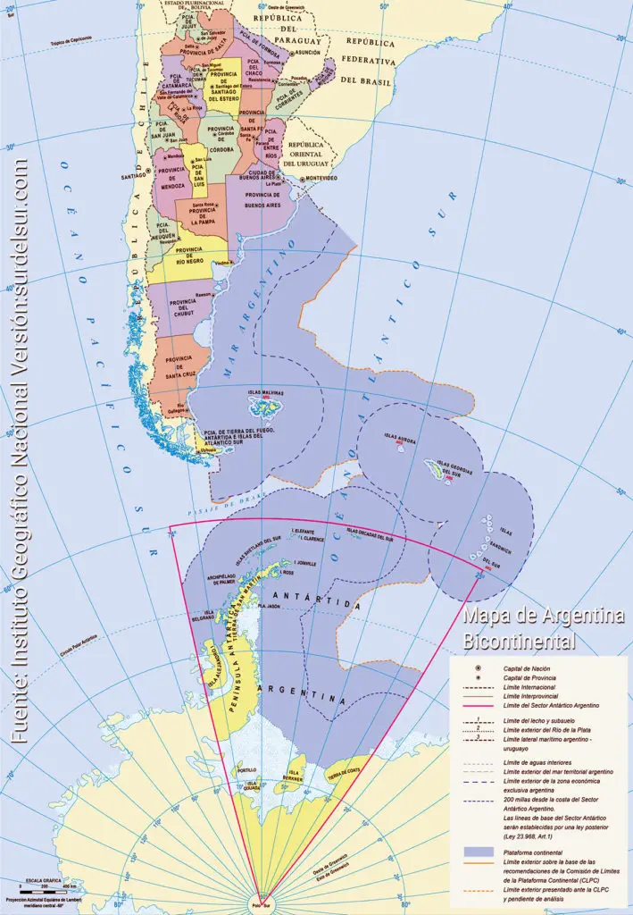
Finally, and as a consequence of this process, the structuring of the Argentine territory could be achieved.
It has:
- A surface of 1,077,923 sq. mi. (2.791.810 km2), which corresponds to the American emerged portion.
- An Antarctic portion of 372,819 sq. mi. (965.597 km2).
- Its outline is 14,493 Km.
- The boundary lines with neighboring countries 5, covering 9,376 Km.
- Its coasts of Argentine Sea and River Plate totaling 5117 km.
More details on the measures, endpoints and neighboring countries can be found in the report on Dimensions Argentina.
Argentina is divided into 23 provinces and the Autonomous City of Buenos Aires.
For more information on location, size and population of the provinces see the report of Argentine Provinces
We also suggest you check related to this report: Conquest and Colonization of the Río de la Plata, The Foundation of the Argentine State, Argentine Modern State
References:
- Instituto Geográfico Militar. Argentina Political Map [Mapping].

