Argentina’s geographic regions are very dissimilar. There are plains and mountain ranges; woods and jungles; arid, swampy, or clayish lands. Traversing the country along its latitude (3.779 km, according to IGN) is a long way.
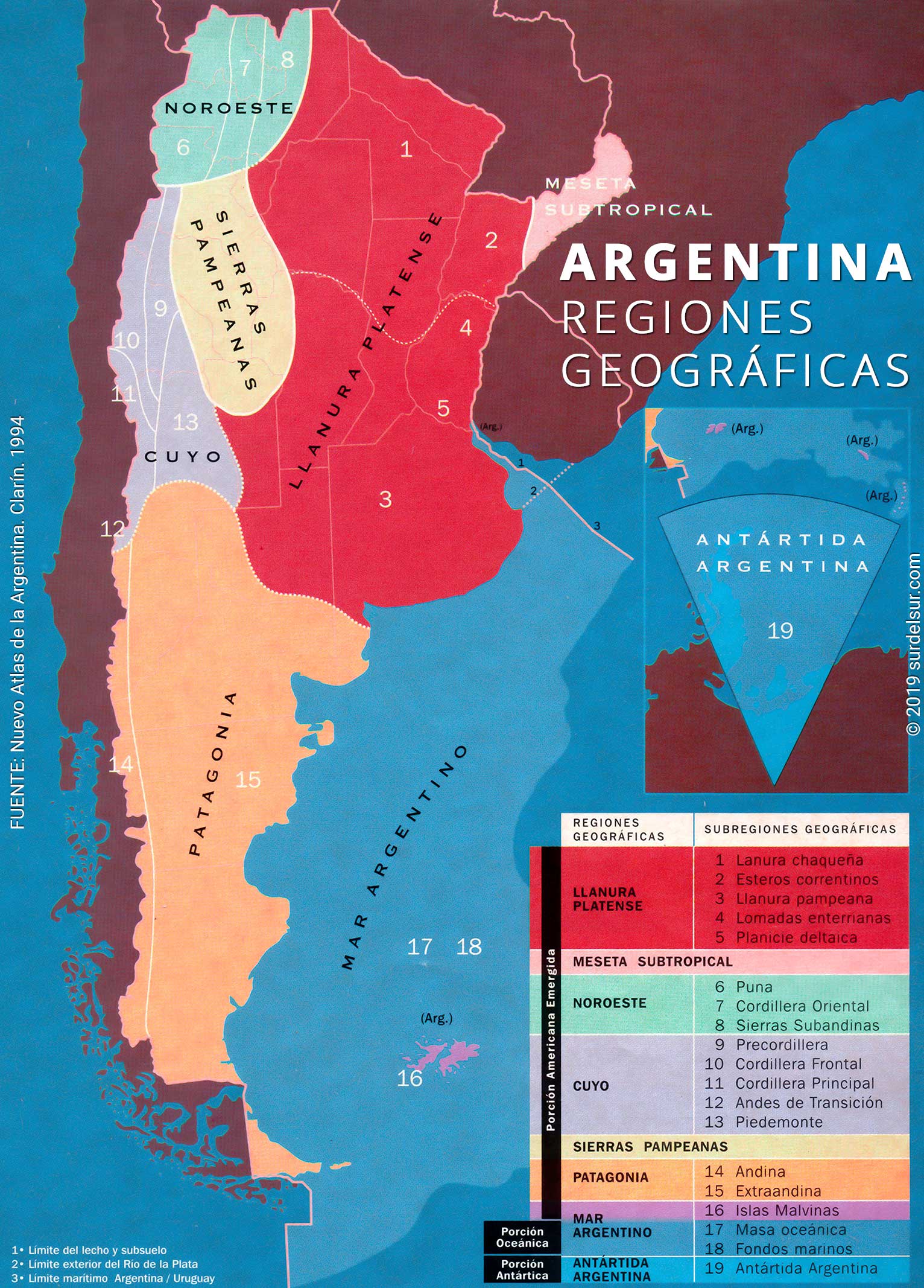
From the point of view of geography, Argentina can be divided into eight different regions defined by a homogeneous climate and relief; these, in turn, are sub-divided according to its most salient features; to learn more about the climate in different regions see Types of Climate of Argentina
CONTENIDO
What is a geographic region
A formal natural geographic region is considered to be the portion of a territory characterized by a certain homogeneity in its relief and climate, as well as in its resources.
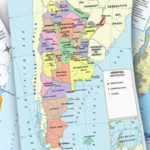
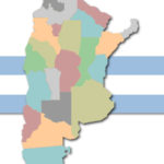
The great richness and versatility of the landscapes of Argentina make their regionalization complex. However, we choose to present in this report the most accepted geographical criteria. The different authorized opinions coincide in pointing out 8 geographical regions of Argentina, which, in turn, are divided into 19 subregions.
Location map of the geographical regions of Argentina
1- Plata Plain Region
This great surface of 463,322 sq. mi. (1,200,000 km2) is located in the north-east of the country and its boundaries are set to the north by Pilcomayo, Paraguay and High Paraná Rivers; to the south, by Colorado Rivers; and the west boundary is set by the foot of the big mountainous masses.
The Plata Plain is, in turn, divided into the following regions:
1-1 Chaco Plain Subregion
The Chaco Plain is located to the northeast of Argentina. It limits the north with the Pilcomayo River, east to the Paraguay River and in the south with the mountains of Cordoba and the Salado river to its confluence with the Paraná river.
It occupies the north part of the region and integrates four morphological units: the High Chaco, whose soil has thick sands and slime; the Depressed Chaco, which presents wide surfaces covered by swamplands and marshlands; the Low Chaco, characterized by its clayish-sandy soil and by the numerous swamplands and frequent floods; finally, there is the Fluvial Diagonal of Santiago del Estero, with its vast swamplands.
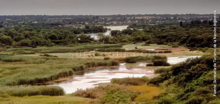
1-2 Corrientes Marshlands Subregion

The estuaries and marshes are depressed areas, located in the Province of Corrientes, which is part of the Plata Plain and is situated between the Paraná and Uruguay rivers.
The waters of Alto Parana, whose channel was moving westward was leaving sandy sediments and contributing to the formation of dunes that were fixed by vegetation.
Different changes of relief and climate determined the formation of marshlands; the most important ones in this area are those of Iberá, Maloyas, Batel y Santa Lucía.
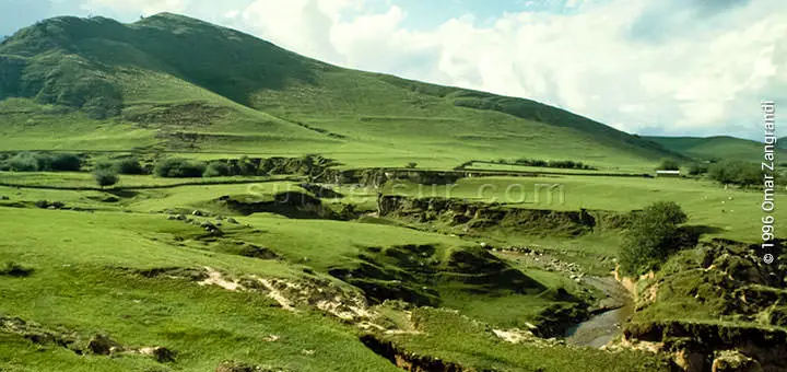
1-3 Pampean Plain Subregion
It is located in the south of the region. Three different types of low sierras are found in this area: Mahuidas, Tandilia y Ventania.
The Pampa Plain is divided into three parts: the undulating Pampa, whose territory presents soft slopes, where you can distinguish ravines and fluvial terraces; the depressed Pampa, with permanent floods and the high Pampa, where some salty lagoons, salt-pits and dune formations can be found.
1-4 Entre Ríos Slopes Subregion

This sub-region can be found towards the east of this region and the south of the Corrientes Marshlands.
With a slightly undulating relief, it presents clayish soils and copious rainfalls.
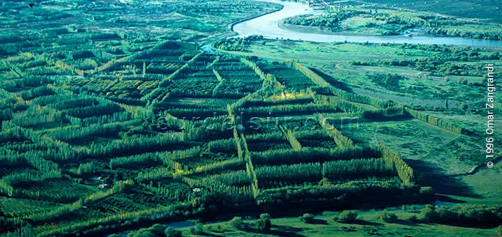
1-5 Deltaic Plain Subregion
This area of 14000 m2, is at the south of the Entre Ríos Slopes, and it is limited by Entre Rios, Santa Fe, and Buenos Aires canyons.
The islands characterizing this region were formed by the constant deposit of sediments from the Paraná River. A slow and permanent delta-forming process determines the constant change in the shape and size of the islands.
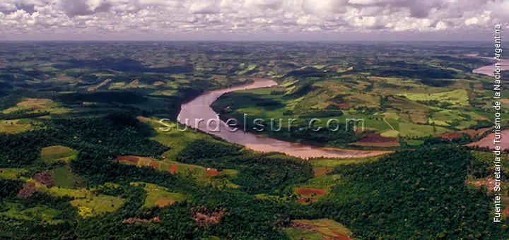
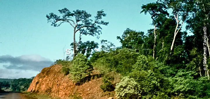
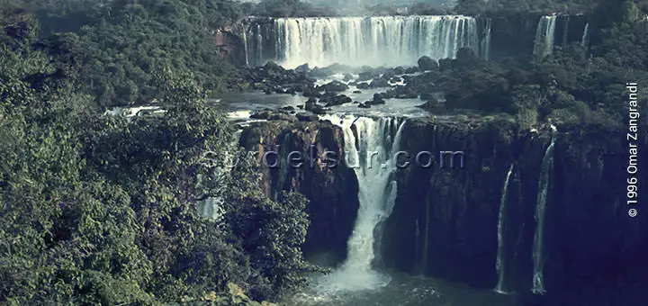
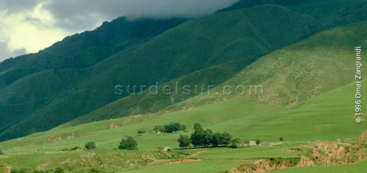
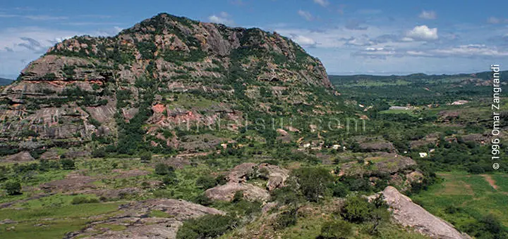
2- Sub-tropical Plain Region
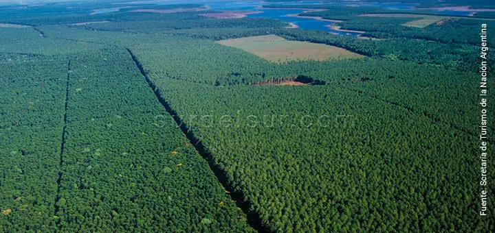
This region is located towards the north-east area of Argentina, its boundaries coincide with those of Paraguay and Brazil, and it is separated from the Plata Plain by the Aguapey River.
The frequent rains determine the vaulted relief of this plateau due to the erosion they produce. Furthermore, it presents some hills which are about 3,280 ft (1,000 m) high.
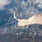
The rivers in this area usually have waterfalls and brooks and define the important hydraulic potential of the region. Las Cataratas del Iguazú fueron declaradas Patrimonio Natural de la Humanidad por la Unesco en 1984.
3- The North-West Region
As indicated by its name, it is located in the north-west area of the country. It is divided into three sub-regions:
3-1 Puna Subregion
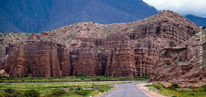
It is a vast altiplano going beyond the boundaries of Argentina. Argentina limits at the north with Bolivia and in the west with Chile.
The place is characterized by plateaus between 9,842 and 11,483 ft (3,000 and 3,500 m) high, separated by sierra ranges. Cafayate in Salta is in the limit between the Puna and the Eastern Cordillera.
3-2 Eastern Cordillera Subregion
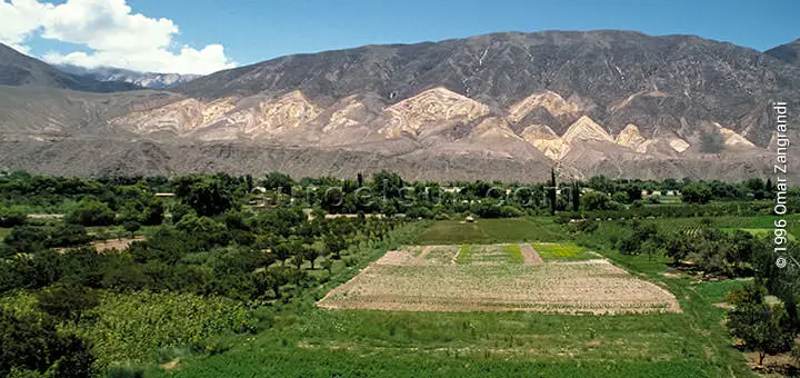
Limits in the west with the Puna and in the east with Sub-Andean Sierras, it develops in north-south direction, between both.
It presents three different kinds of relief: one of them is mountainous, within which you distinguish two chains, the Western and the Eastern. In the Western the most important peaks are Aguilar and Chañi with 6200 masl in Jujuy; Cachi, Acay, and Cumbre del Obispo in Salta. In the Eastern, we found lower mountains represented by Sierras de Santa Victoria in Salta and Tilcara in Jujuy.
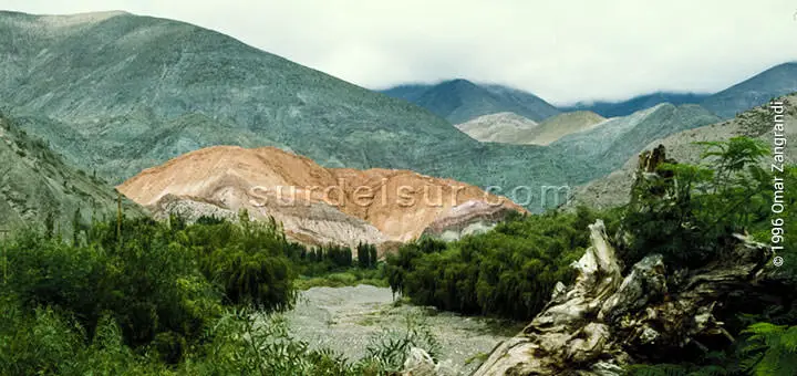
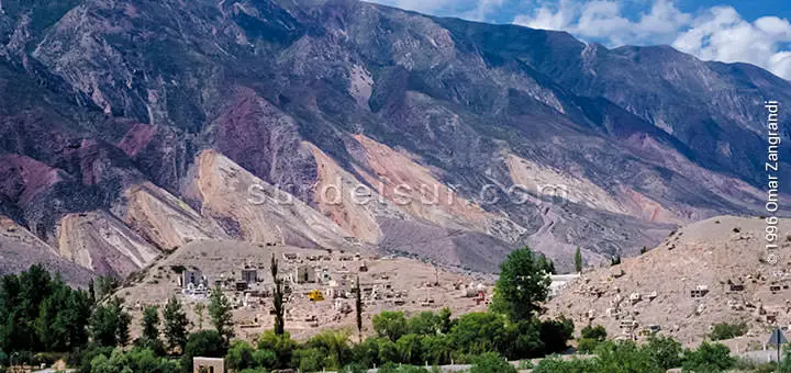
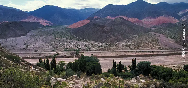
Another relief kind is represented by quebradas. The Humahuaca and the Santa María-Guachipas are among the most important. The best known of the appointed place is definitely the Quebrada de Humuaca and its western branch, the Quebrada de Purmamarca, which resembles a large valley in front of the Rio Grande, where the Cerro de los Siete Colores stands. Humauaca Clough was declared a Cultural and Natural Heritage in July 2003 by Unesco.
The valley, generally wide and with soft slopes, like the valley of Jujuy and the Lerma in Salta. To the north, the Valle de Lerma connects to the Quebrada de Humahuaca, Jujuy; the southwest with the Quebrada del Toro coming down from the Puna de Atacama, and the south borders the Calchaquíes Valleys, Tucumán.
3-3 Sub-Andean Sierras Subregion
They are low, parallel sierras, looking from north-east to south-west.
Limited to the west by the Cordillera Oriental and on the east by the Chaco Plain. They develop along the provinces of Salta, Jujuy and Tucumán, from the border with Bolivia in the north to the valley of the Sali River in the south.
Comprises the Sierras de Oran, del Alto, Candelaria and Tartagal in Salta; Zapla, Santa Barbara, Centinela in Jujuy; Cresta de Gallo, between Salta and Jujuy; and Ramada in Tucumán among others.
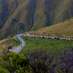
4- Cuyo Region
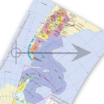
The fourth of the geographical regions of Argentina is located in the center west of the territory. The Cuyo area is located next to the western limit of the country. There, it extends from the Puna to latitude 37º south. Traditionally, it is located in the provinces of San Juan, Mendoza, and San Luis, by cultural and historical unity. However, in the geographical region of Cuyo, La Rioja is also usually included.
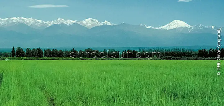
As can be seen in the image, the mountainous area is characterized by high peaks and constant snowfall. It presents the highest peaks in Argentina, including Aconcagua, the highest peak in America, with 22,381 ft (6,959 m)
Indeed, Cuyo stands out for having a large orographic mass to the west and foothills to the east. Its mountainous relief presents the following orographic systems:
4-1 Subregion of the Precordillera
The foothills, is a mountainous area of more than 450 kilometers in length, covering part of La Rioja, San Juan, and Mendoza. It limits to the east. first with the Pampean mountains and further south with the foothills of Cuyo. On the other hand, on the west, it limits in its entire length, to the Frontal mountain range. It is separated from it by the valleys of Rodeo, Iglesia, Calingasta, and Uspallata.
This geographical subregion presents three parallel mountain ranges, separated by narrow and elongated valleys. Their tops are flat due to erosion. With an approximate length of 150 kilometers each of them.
The mountain ranges located from North to South are:
- Northern
- Central
- Southern
The maximum height of the Precordillera is found in the Cerro la Bolsa, with 4924 meters, in the province of San Juan.
4-2 Frontal Cordillera Subregion
In its northern portion, the Frontal Cordillera presents volcanoes, plateaus, saline basins, and high-altitude lagoons. To the south, it forms a mountain range made up of peaks that exceed 5,000. An example of this is the Cerro del Potro (5,871m) and the Mogotes (5,411m) in the north of San Juan.
However, the most prominent geographical feature in this area is the Mercedario hill, 6,770 meters above sea level. It is the highest in the province and the fourth highest in America. It is located in the extreme southwest of the province of San Juan, in the department of Calingasta.
To the east, there are high ranges separated by the valleys of the rivers of the Desaguadero system. The main cordons from North to South are San Guillermo, Colanguil, Ansilta, del Tigre in San Juan, and Cordon del Plata in Mendoza.
4-3 Main Cordillera Subregion
To the west of the Frontal Cordillera, and parallel to it, rises the Principal Cordillera. Its peaks mark the oceanic watershed, and form the border with Chile. The highest massifs are isolated to the east. The height of the passes decreases progressively towards the south, going from 13123 ft (4,000 m) in the north to 8202 ft (2,500 m) in the south of Mendoza.
The same happens with the height of the summits, which decreases towards the south. They go from 22300 to 13451 ft (6800 to 4100 m) high. Most are inactive volcanoes, such as Tupungato 22342 ft (6810 m), Maipo (5318 m), Overo 16043 ft (4890 m), and Peteroa 13494 ft (4113 m). The spectacular Aconcagua hill, the highest peak in America, with 22,381 ft (6,959 m) belongs to this Argentine geographical region. It is the second highest in the world, after the Himalayan system.
4-4 Transitional Andes Subregion
The southern sector of the Principal mountain range is called the transitional Andes. In this sector, the characteristics of the central Andes begin to be lost to adopt the morphology, climate, and biome of the Patagonian-Fueguian Andes. Visually, the sharpest peaks with ridges and rocky peaks stand out.
4-5 Piedmont Subregion
The Piemonte is the plain that is located to the east of the Cuyo region and merges with the Pampas plain. It is a xerophilous steppe with little rainfall. It is one of the driest places in the country. Among the most important activities is the cultivation of grapes or vines, with the use of irrigation.
In the image below, extensive foothills can be seen, to the east of the mountain ranges. Which constitutes the flat part of the region.
In relation to its hydrography, this area presents rivers with a melting regime. They make up the Desaguadero system.
The foot of the mountains, to the east of the mountainous ranges, constitutes the plain area within this region. In hydrographical terms, this area presents rivers with a thawing regime, making up the Desaguadero system in one of the driest places in the country.
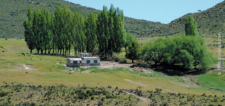
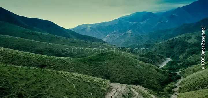
5- Pampas Sierras Region
This region is in the center of the country, occupying part of the provinces of Tucumán, Catamarca, La Rioja, Santiago del Estero, Córdoba, San Luis y San Juan.
The predominance of Sierra ranges with flat tops, separated by valleys, fields, or hollows, is the main characteristic of the area.
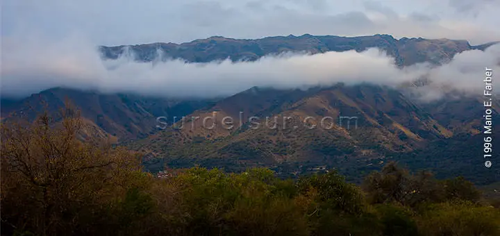
The mountain ranges, which we mentioned before, make up chains. These chains are the following four:
- The Oriental or Sierras de Aconquija, with the Nevado de Aconquija at 18208 ft (5,550 m), divides the provinces of Catamarca and Tucumán.
- The Austral, with Cerro Champaquí at 9153 ft (2,790 m). This hill, the highest in the province, belongs to the Sierras Grandes that separate the Traslasierra Valley and the Calamuchita Valley in Córdoba.
- The Central or Velasco where the Morado massif with 16141 ft (4920 m). is located in the Province of La Rioja
- Finally, we have the fourth chain, called the Occidental or Famatina system. It is in the center of La Rioja, where Cerro Gral. Belgrano stands out, also known as Nevado de Famatina with a height of 20003 ft (6097 meters above sea level), which is the highest of South America’s extraandina summits.
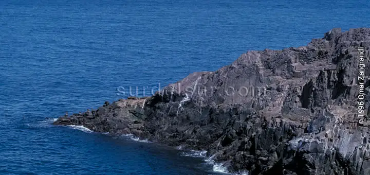
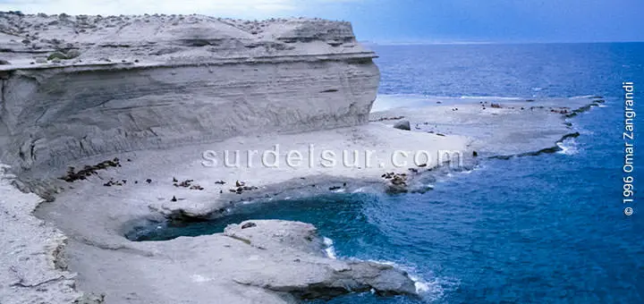
6- Patagonia Region
Located towards the south of Colorado River, Patagonia is divided into two sub-regions:
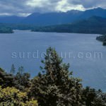
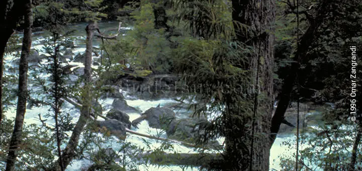
6-1 Andean Patagonia Subregion
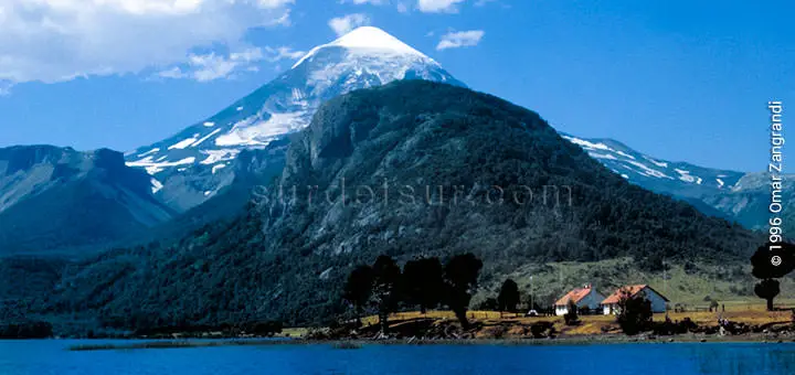
It is compounded by mountain ranges separated by valleys and lakes, whose summits are covered by glaciers.
Most of this territory is made up of national parks, which contain remains of the last glaciation in the continental ice field. Among them stands out Los Glaciares National Park with the Perito Moreno glacier in Santa Cruz, which was declared a UNESCO Natural Heritage Site in 1981.
The rivers of the region are torrential. An example of this, are the Manso, Futaleufú, Pico, and Santa Cruz. They also respond to two slopes, the Atlantic and the Pacific.
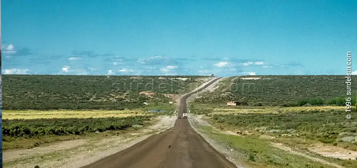
6-2 Extra-Andean Patagonia Subregion
It is a plateau, and its morphology is varied and complex, presenting stair-shaped plateaus, sierras, depressions, and wide fluvial valleys.
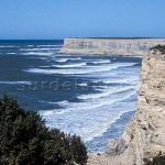
7- Argentine Sea
From de Argentina geographic regions, the seventh region is the Argentine Sea. With a 386,102 sq. mi.(1,000,000 km2) surface, the Argentine shelf is one of the largest ones in the world and it is covered by the Argentine Sea.
It progressively widens towards the south and is morphologically similar to the Extra-Andean Patagonia, due to the stair-shaped plateaus.
The Malvinas Islands are within the Argentine platform. The Argentine Sea generally presents a moderate surge and its tidal-range increases towards the south.
7-1 Islas Malvinas
The emerged insular part: This area is made up of the South Atlantic Islands, among which the Malvinas Islands stand out, which are located within the Argentine continental shelf.
7-2 Seabed Subregion

The seabeds present a progressive widening as they move towards the south and, morphologically, it has a certain similarity with Extra-Andean Patagonia, due to the plateaus in the form of steps, which descend towards the east.
In the most recent update of the bicontinental map of Argentina carried out by the National Geographic Institute, the layout of three areas in the Argentine Sea is noted. First, the limit of the Argentine territorial sea that borders the Argentine maritime coast. Second, the limit of the Argentine exclusive economic zone. Third, the outer limit of the Argentine continental shelf. The latter coincides with the presentation of April 21, 2009, before the Limits Commission of the UN.
From a geological point of view, seabeds are considered to be the natural prolongation of the continental masses below sea level. They are made up of three elements:
- Continental platform: includes the bed and subsoil of the submarine areas up to the outer edge of the continental margin, which extends beyond its territorial sea. The limit is defined by the presentation made by Argentina on April 21, 2009, before the United Nations Commission on the Limits of the Continental Shelf and accepted by the latter on March 11, 2016.
- Emerged insular part: This area is made up of the South Atlantic Islands, among which the Malvinas Islands stand out, which are located within the Argentine continental shelf.
- Slope: The continental platform falls abruptly, forming a slope or slope, which ends in the Argentine Basin. The deepest point in the basin is the Argentine Abyssal Plain at the base of the Malvina’s escarpment or slope, which reaches a depth of 6,212 meters.
7-3 Subregion Oceanic Mass
The oceanic mass that covers the Argentine continental platform, is formed by the waters of the Atlantic Ocean, which in this area constitutes the waters of the Argentine Sea.
The Argentine Sea generally presents a moderate swell and the amplitude of its tides increases towards the south.
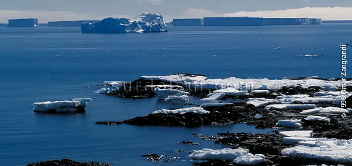
8- Argentine Antarctica
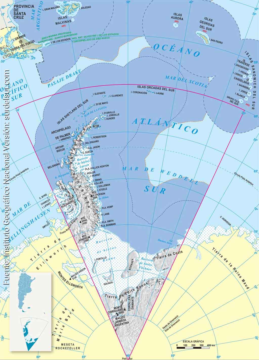
When we say that Argentina is bicontinental, we refer precisely to the fact that a portion of Argentina is in South America and another is in the Antarctic continent. This portion of our territory is called Argentine Antarctica as of October 27, 2017, previously it was called Argentine Antarctic Sector.
Antarctic Continent
The continent of Antarctica, where the South Pole is located, is considered a continent by basement, unlike the North Pole in the Arctic region which is just ice. The Antarctic continent has an almost circular shape, from which the Antarctic Peninsula protrudes in a south-north direction. It has a diameter of about 4,500 km and an area of about 14 million km2. It is estimated that less than 1% of its surface is free of ice.
It is the coldest, driest, and windiest continent. In addition, it boasts the highest average altitude on the planet, more than 2,000 m above sea level. The Vinson Massif, with an elevation of 4,897 meters above sea level, is the highest mountain in Antarctica. Antarctica is larger than Australia and somewhat smaller than South America. It is separated from the latter by the Drake Passage or Hoces Sea.
Antártida Argentina
From Argentina’s geographic regions, Antarctica is the southernmost region of the Argentine territory, it is covered by ice and snow most of the year.

This region sits on the Antarctic tectonic plate.
The Argentine Antarctic Sector is characterized by including a large peninsula elongated S-shaped, which is crossed by Antartandes, geologically, turns out to be a continuation of the Andes.
The topography is rocky outcrops, called nunatak; and winds reaching 124 mph (200 kmph) form ice dunes, called sastrugis.
This region is compounded by these islands: South Orcadas, South Shetland, Decepción, Palmer, Biscoe, Belgrano, Elefant, Clarence, Berkner, Portillo and Quijada.
Bibliography
WAS THE ARTICLE USEFUL TO YOU? SAVE IT!!
READ THE RELATED ARTICLE…!